
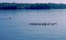
This part added Nov 6:
That's at the south rim, above, last year at Grand Canyon National Park. Below is a mule train, this week, leaving from that basic location to "Plateau Point", 3200 ft down, and with an overlook to the Colorado River another 1200 feet down. For perspective, the location for the pic above is at the bottom of the bendy curve in the horizon, down and just left from where the contrail hits the horizon (see here for a map). In the pic below the treed area in the background is Indian Garden, and the trees are thanks to a natural spring that drains down into the Colorado. They say that 7 of the world's 8 basic climate zones are represented in the trek from the top of the canyon to the river .. I believe it.

If you're not taking a mule down Bright Angel trail, this is the way down: South Kaibab Trail (if you expand this picture you can see two people coming up the trail on the extreme left, and smaller still two people going down right by the bottom switchback .. gives some perspective):

At times you walk alone, with your thoughts, the canyon walls, and the promise of a warming morning sun and a river somewhere below:

First stop, Ooh Ahh point, with the "battleship" butte in the near background, and the North Rim in the distant background. In between is our destination, the Colorado River.

The views are spectacular ..

A look over to Plateau Point, and the trail from Indian Garden (not visible) out to it (the worn area at the end is the mule rest); some beautiful views of the river and canyons within the canyon from there:

If you blow that picture up, there's a little green patch to the right (east) of Plateau Point, and you can see a little snippet of the river. Bright Angel trail comes up from the river through that green patch. That was our return route, and you'll get to see some hanging gardens on the way.
The walk down is beautiful -- South Kaibab Trail was built with tourists in mind while Bright Angel Trail was still privately owned -- on top of the ridges and buttes, and thus with the great vistas. Of course, some guys can find trouble anywhere (late note, my wife's caption for this picture is better than mine, she called it "Wrong way, Sisyphus"):

While others just minding their own business:

Blister stop:

Ah, a glimpse of the river, and, look hard, it has visitors (visible if you blow up the picture). This will be our lunch stop, and then begin the uphill climb.

Finally, almost there, and then ... there (well, through a tunnel, over a bridge, down a little hill, and there)! By the way, in the bottom left picture the treed area to the top (north) of the river is the lead-in to Phantom Ranch (the green patch on the right hand side of the first picture; detailed pic here, you can actually see people), the single lodge at the bottom of the canyon. This is the stop-off point for many (wimps) who want to spread the "Rim-to-rim" or the "down and up" trek over two days. We thought we were okay doing down and up in a day, only to have a guy join us (and our flashlight) for the last half hour of our trek on the tail end of his "rim-to-rim-to-rim" 48 km single day sojourn. That will be my goal for next year, I guess. Also, if you blow the picture up, you can see the second (westerly) of the two foot bridges crossing the river, this one people only, and leads to the Bright Angel Trail which after 9-10 miles or so takes you back (in the dark, for us) to the South Rim. The east bridge in the pic on the right and below is at the bottom of the South Kaibab Trail and is heavier duty, for mules and people.


And yes, you get to dip your feet in the Colorado:


In the background is the oldest section of rocks that make up the canyon, the Vishnu Schist layer; to get an idea of the relative size of this layer to the whole canyon, see here. Then lunch on the beach with some other trekkers, watching some Spaniard river rafters (the visitors spotted from above) getting ready to continue their 16 day ride down the river:

Some company, the rafters:

Oh, and hi to you, too, you don't mind, do you (you look hungry)?

And you, we know you're watching

Okay, time to go. Just remember, as the sign on the way down says, "Getting down is optional, getting up is mandatory!"

Now the rafters have caught up, lots of company. Here the trail goes along the river for a mile or so, the connector from South Kaibab to Bright Angel Trails. A thousand or so feet up (still three thousand + down from the South Rim), at about Plateau Point elevation, a second trail, Tonto Foot Path, connects the two.

A last look, the river wasn't much more than this, when, a mile up and 5 million years ago, it started journey downward, through the Coloardo Plateau:

The journey back. Getting dark, but still gotta suss out the great views:

{Six or so hours later ..} Made it! (note what's in my right hand: essential!):

Five minutes earlier, emerging from the dark (and cold) at Bright Angel Trailhead .. whew!

Okay. Top it off the next morning with some sunrise pics


and then listening to Ranger Dave. In thirty minutes you'll learn more than you ever thought you could know about the Grand Canyon, trust me

-----
Two days earlier we were at Zion Park, this is the last stretch to aptly named Angel's Landing. After a 2 hour climb you're confronted with a final challenge: cross this narrow ridge, 800 ft drop on one side and 1200 ft drop on the other, and you're there ...

and yes, we shall walk that wall

da climb (I'm a little spec on the middle-left)

only to find in the end that somebody has got your spot:

Another view:

Fly away? I can still see you ..

Concentrate, the view down is a bit dizzying:

To think about, the outer ring below is the road, the inner ring is the Virgin River. Where I stood to take this picture, at one time I would have been at the bank of that river. There's a saying by the great one-armed civil war general and Colorado River explorer John Wesley Powell that goes something like this: "Deep time gives water dominion over rock." Amazing but true.
----


7 comments:
It looks glorious. And the pictures are superb. Compliments to the photographer. I must go. After Petra and Cappadocia and Arches and the crater on Haleakala, I know I'll love it there, too.
There's a walk in the Annapurna foothills that I'm very intrigued by - a seven day route and a 21 day route.
Have you two adventurers tried diving? I recommend Dahab.
...and the picture of the two of you on the bench at the end: beautiful.
Dawn,
That's kind of you to say, thank you. One of the kids was in Annapurna recently, sounds heavenly. We've done the Haleakala thing, but mildly stymied due to overcast conditions at the top. We did get to the top of Mauna Kea thanks to some generous Nebraskans who got us from 9000 to 14000 ft in their 4x4. Also, I have some nice pictures of the Kilauea caldera too, definitely out of this world.
One of the nice bits about doing this stuff is the people you meet. On the way up we ran into a couple of guys from Quebec City. They had a slow but steady pace, easy enough that we could have some nice chats (election, American-bashing, travel, they'd been all over, typical stuff) .. they fell behind, had no light, so when they showed up in the lodge there was some relief and the obligatory jokes.
Oh, no to the diving. We actually scheduled a trip to Saba, just off St Martin, cause my wife and one kid were getting their certification, but they didn't do the final dive or test. That's not for me, I'm a decent swimmer and do the snorkeling bit (e.g. Dawn Beach in St Martin, I bet TQM has been), but that's about it.
Thanks again for popping in ..
Outstanding! How the hell did I miss this? You really did go all the way down and back in a day. Psycho!
Beautiful pics.
The "Somebody's going to the Grand Canyon" pic, is that the road north of Williams? Sure looks like it.
(I'm going back again for the 3rd straight year.)
Michael, thanks. Most were taken by my wife and/or kids -- though I took the one of her in mid-air. It's actually on the north side in Utah, the highway from Moab towards Page. Our loop was Vegas to Zion, get up Angel's Landing by early afternoon, then overnight in Moab, then around the Canyon sort of clockwise, eventually coming in to South Rim from the east. I would highly recommend it. As I recall, we left Moab quite early, and basically had the highway to ourselves. The year before we had come in from Vegas the more traditional way, to Williams then north. By the way, the day before the down and up we had hiked out to Plateau Point and back (that's where we saw the mule train). We weren't going to do the down and back, because of the warnings and all that, but in talking to some people we met in Indian Garden who were on their way back from the bottom, we realized it was something we had to do.
Took 64 north from Williams (twice) going in, and this year took 89 to Cameron (east) on the way out. I will take the eastern entrance to the park from now on, both directions. That Little Colorado Gorge is spectacular, and the road was essentially deserted. I think at Cameron, if I'd gone north, I would begin the reverse clockwise of your route. Def want to see Canyon de Chelly and all that lies along the AZ UT border.
These pics you took are just awesome. I recall seeing the one of you at the floor by the big old Vishnu boulders, but the rest is new.(Fray post maybe?) Terrific stuff. Makes me want to go back right now.
A quick vid I took at Grandview Trailhead
Well, I got in on the ground floor there, viewer number 4. I didn't get to Grandview, but was on my list for next time. And I saw that other vid about the rim-to-rim hike. I talked to a guy who went rim-to-rim-to-rim in a day.
By the way, the previous comment should have said Kanab, not Moab, I realized that when I looked at a map. We were contemplating seeing the north rim, but it didn't make sense to try to fit it in to our schedule. I have some great pics of that little Gorge, maybe I'll post a couple if I have time. The rest have been up for a couple of years. We were really lucky, it was a trip where everything went right.
Post a Comment